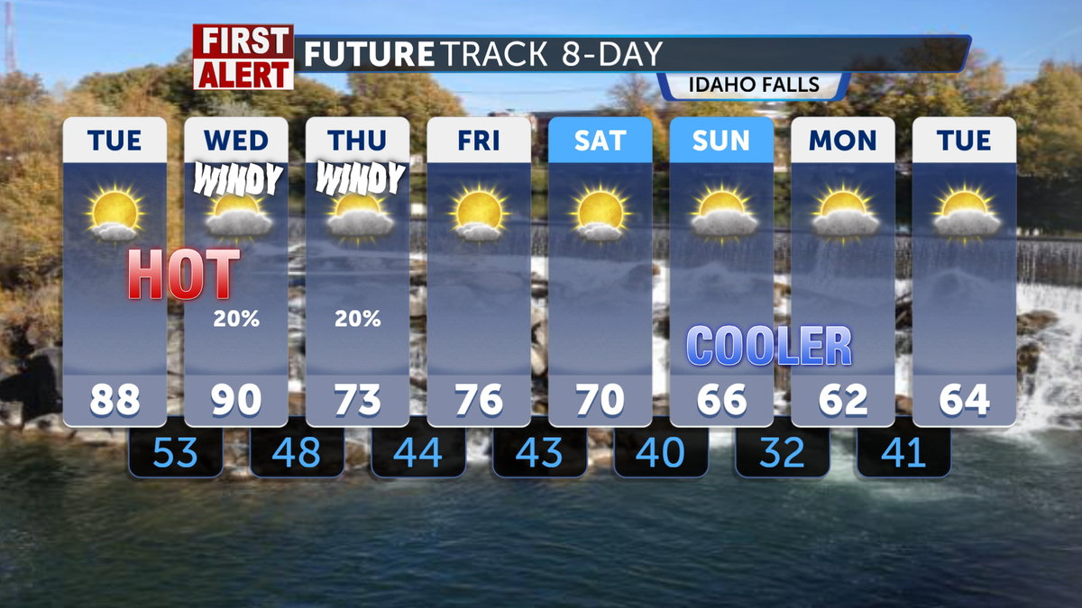

The record-breaking high temperatures from earlier this week will take a brief pause as we cool down due to the First Alert Weather on Wednesday. We can expect temperatures to return to the 60s and 70s for the remainder of the workweek, accompanied by calmer winds and drier conditions, wrapping up this unpredictable week in May.
The sunshine will return to the forecast for this Thursday, with highs in the upper 60s and low 70s. A bit of a drop-off in temperatures from earlier this week. where we saw record-breaking highs reach the upper 80s. Leftover winds from yesterday will shift from the southwest at around 15 to 25 mph, with gusts up to 35 mph.
Friday’s forecast indicates another day of sunny weather, with a high of 69°F. It will be breezy, with southwest winds at 15 mph, increasing to 20 to 25 mph in the afternoon. Winds may gust up to 40 mph.
Over the weekend, will dip into cooler temperatures, with some more elevated regions experiencing overnight freezes. Mountainous areas can expect the possibility of frost slipping into the weekend forecast by Sunday.